Maps
Below:
James Chadwick's map of Liverpool of 1725:
James Chadwick's map of Liverpool of 1725:
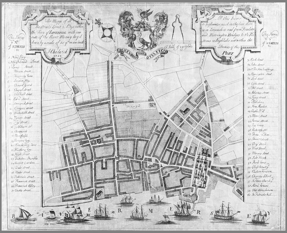
(Source: James Chadwick, 'The Mapp of all the Streets, Lanes & Alleys within the Town of Liverpool with the side of the River Mersey layd down by a scale of 80 y[ar]ds in an inch', Liverpool: 1725.
This map was commissioned by the Liverpool Corporation, and as such, is the first 'official' map of Liverpool)
This map was commissioned by the Liverpool Corporation, and as such, is the first 'official' map of Liverpool)
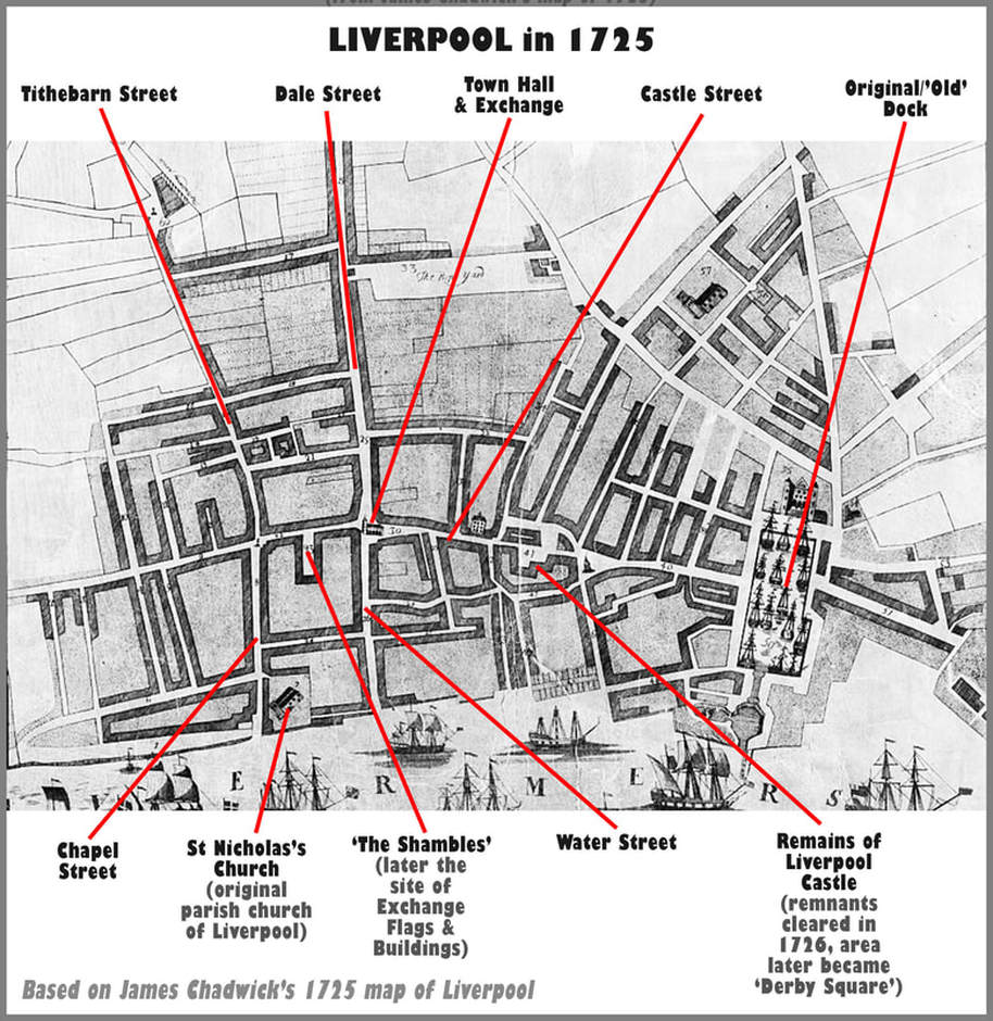
Below:
Central Liverpool in 1725
(based on James Chadwick's map of Liverpool of 1725)
Central Liverpool in 1725
(based on James Chadwick's map of Liverpool of 1725)
Below:
John Gere's plan of Liverpool of 1796:
John Gere's plan of Liverpool of 1796:
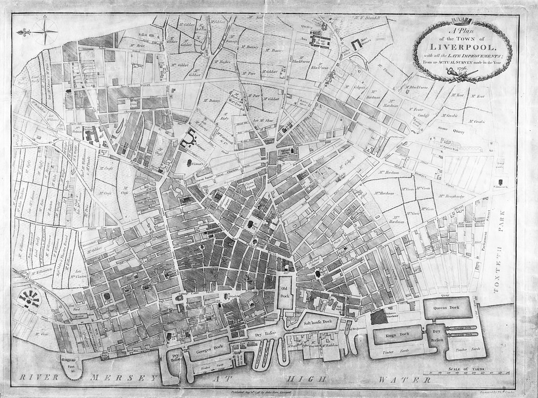
(Source: John Gere, 'A Plan of the Town of Liverpool, with all the Late Improvements; from an Actual Survey made in the Year 1796', Liverpool: 1796.)
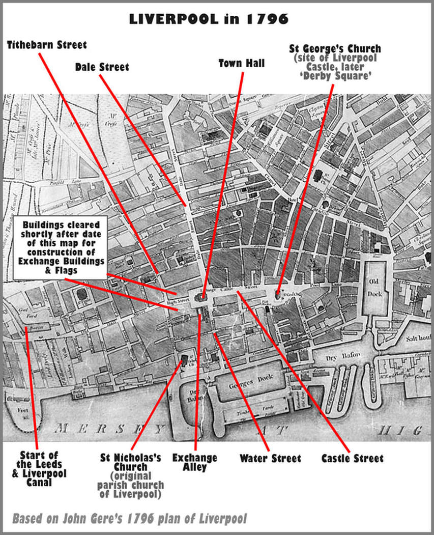
Below:
Central Liverpool in 1796
(based on John Gere's plan of Liverpool of 1796)
Central Liverpool in 1796
(based on John Gere's plan of Liverpool of 1796)
Below: Liverpool and District
in the early 1840s:
in the early 1840s:
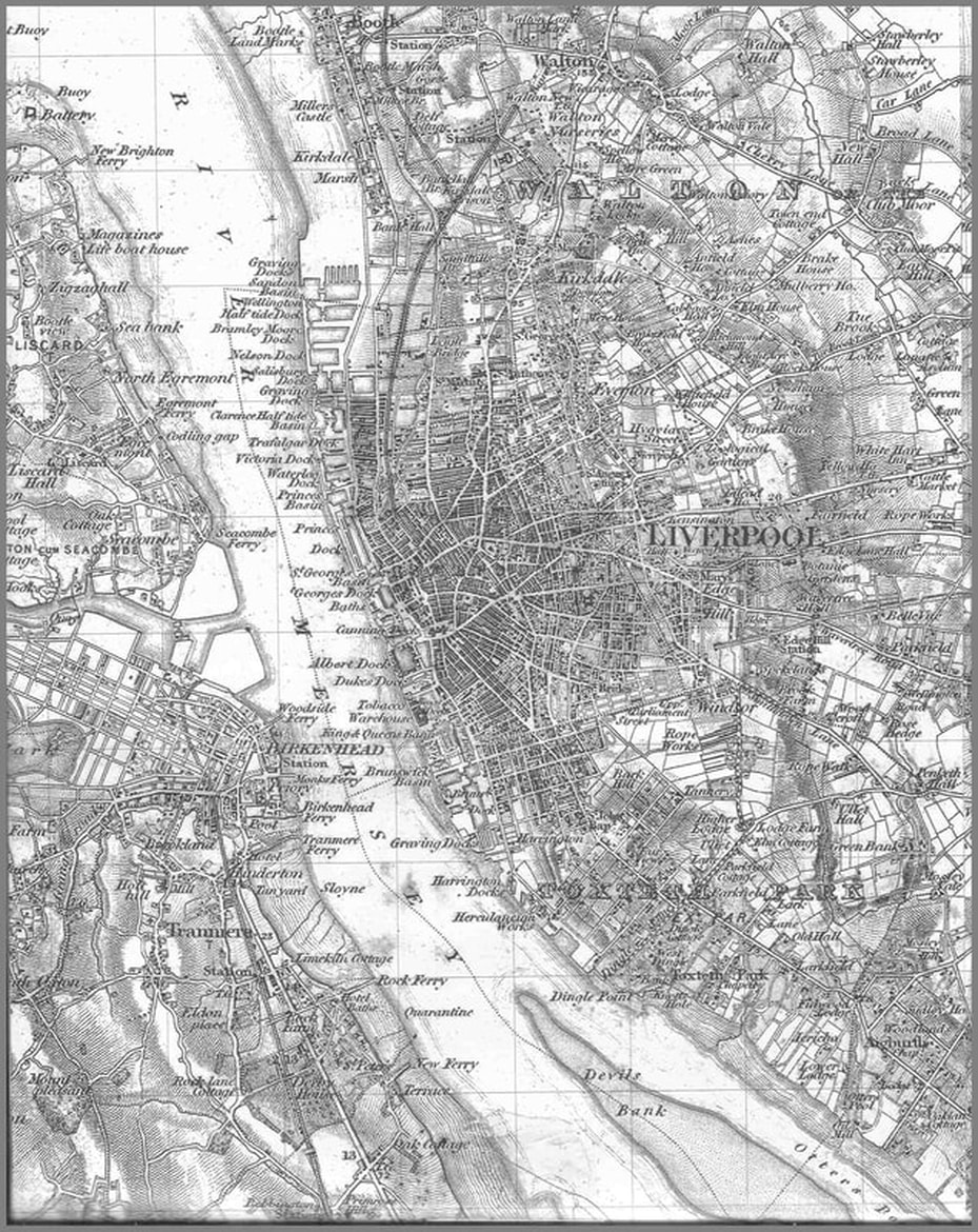
(Source of map: a composite formed from sheets 79, 80, 89 and 90, of the Ordnance Survey 'Old Series'/'One-Inch' maps,
first published 1840 to 1842)
first published 1840 to 1842)
Below: Central Liverpool in the Early Twentieth Century,
indicating key locations connected with the
cotton trade and market
indicating key locations connected with the
cotton trade and market
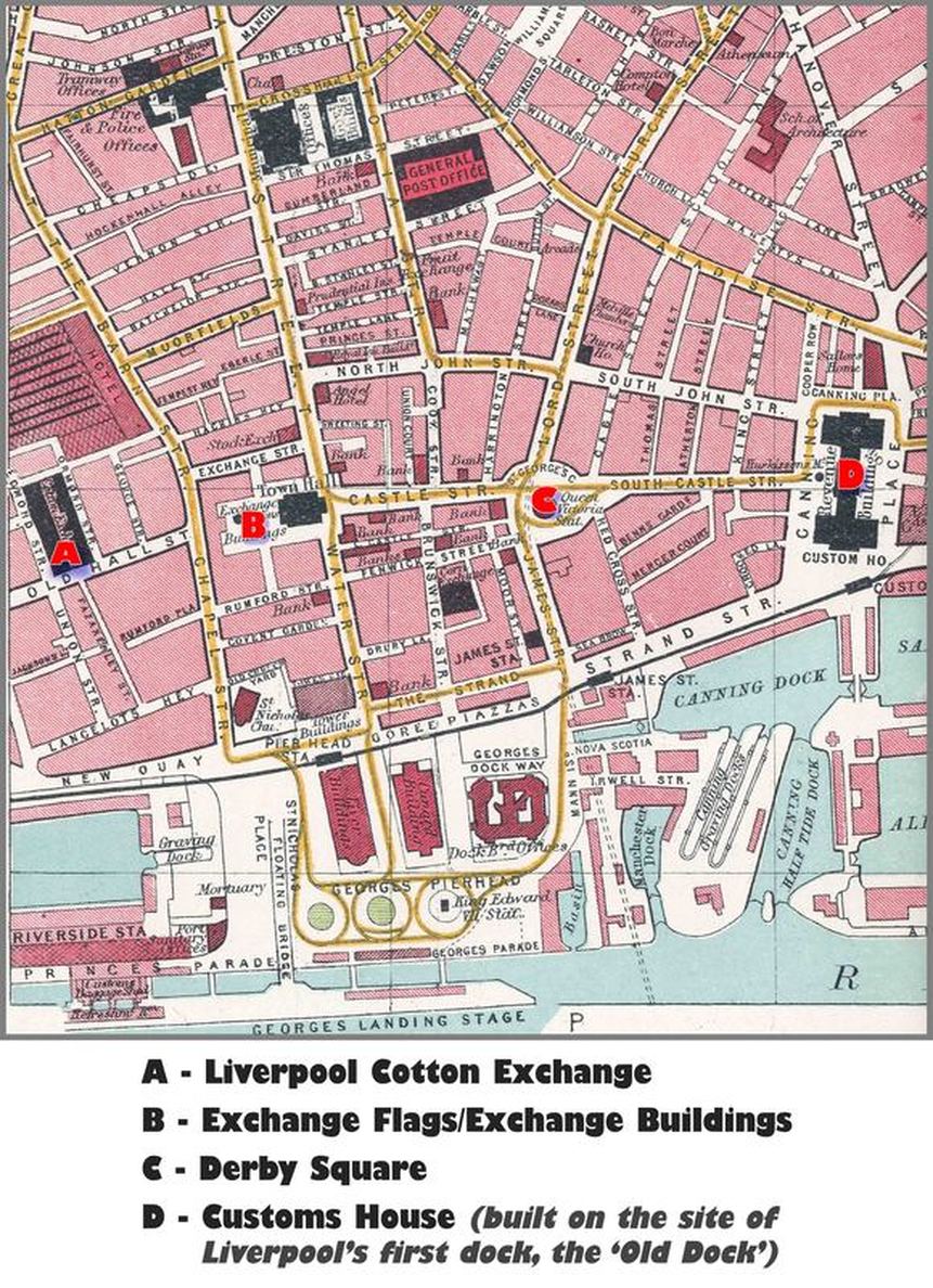
(Source of original/base map: a detail from 'Bartholomew's Pocket Atlas and Guide to Liverpool and Birkenhead', Edinburgh: John Bartholomew & Son, 1928, map section - page 32)